LOCAL RESPONSIBILITY AREAS (LRAS) AND FIRE-HAZARD SEVERITY MAPS
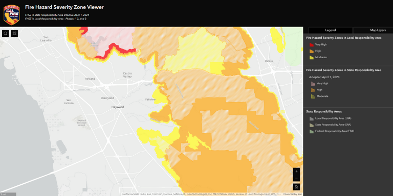
The Hayward Fire Department and Fairview Fire Protection District want to make residents and property owners aware of and invite feedback on new Fire-Hazard Severity Maps covering the City of Hayward and Fairview Fire Protection District.
Click below for more information and to leave a public comment.
To view the Fire Hazard Severity Zone Map, please click on the link below.
https://experience.arcgis.com/experience/6a9cb66bb1824cd98756812af41292a0